Rancho Viejo
Utseende
Rancho Viejo kan syfta på följande platser:
Mexiko
[redigera | redigera wikitext]|
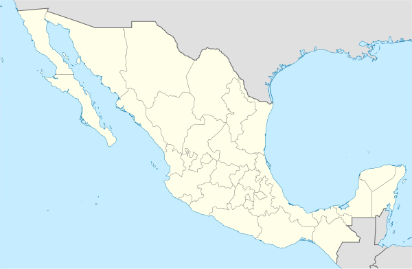
Rancho Viejo i Mexiko. |
- Rancho Viejo, La Misión, 21°02′48″N 99°05′51″V / 21.04661°N 99.09752°V
- Rancho Viejo, Tetela de Ocampo, 19°47′02″N 97°50′41″V / 19.78389°N 97.84472°V
- Rancho Viejo, Huejutla de Reyes, 21°09′46″N 98°19′03″V / 21.16274°N 98.31753°V
- Llano Grande, Ixtapaluca, 19°19′45″N 98°43′30″V / 19.32917°N 98.725°V
- Rancho Viejo, Tlacoachistlahuaca, 17°01′57″N 98°13′26″V / 17.03257°N 98.22389°V
- Rancho Viejo, Tecozautla, 20°33′36″N 99°41′39″V / 20.56°N 99.69417°V
- Río Viejo, Guasave, 25°22′33″N 108°26′01″V / 25.37582°N 108.43358°V
- Nuevo Lindero, ort, Guanajuato, León, 20°57′31″N 101°38′16″V / 20.9587°N 101.63767°V
- Rancho Viejo, Apaseo el Grande, 20°38′53″N 100°39′14″V / 20.64811°N 100.65387°V
- Rancho Viejo, Luvianos, delstaten Mexiko, 19°02′26″N 100°20′23″V / 19.04053°N 100.33968°V
- Rancho Viejo (västra Tantoyuca kommun), 21°22′27″N 98°17′06″V / 21.37417°N 98.285°V
- Rancho Viejo (södra Tantoyuca kommun), 21°17′34″N 98°13′38″V / 21.29278°N 98.22722°V
- Rancho Viejo, San Marcos, 16°51′54″N 99°17′22″V / 16.865°N 99.28944°V
- Rancho Viejo, Tlalnelhuayocan, 19°31′37″N 96°58′41″V / 19.52694°N 96.97806°V
- Rancho Viejo, Nogales, 18°47′05″N 97°12′31″V / 18.78472°N 97.20861°V
- Rancho Viejo, Malinaltepec, 17°02′13″N 98°48′15″V / 17.03694°N 98.80417°V
- Rancho Viejo, Taxco de Alarcón, 18°35′06″N 99°33′47″V / 18.5849°N 99.56312°V
- Rancho Viejo, Constancia del Rosario, 17°01′57″N 97°57′28″V / 17.0325°N 97.95778°V
- Rancho Viejo, Chinameca, 18°01′50″N 94°45′48″V / 18.03056°N 94.76333°V
- Rancho Viejo, Hueytamalco, 19°58′01″N 97°20′00″V / 19.96684°N 97.33338°V
- Rancho Viejo, Libres, 19°31′21″N 97°43′08″V / 19.5225°N 97.71889°V
- Rancho Viejo, General Heliodoro Castillo, 17°53′10″N 100°02′56″V / 17.88605°N 100.04885°V
- Rancho Viejo, Tlaltetela, 19°13′35″N 96°58′38″V / 19.22639°N 96.97722°V
- Rancho Viejo, Pedro Ascencio Alquisiras, 18°28′41″N 99°52′00″V / 18.47793°N 99.86666°V
- Rancho Viejo, Tlaxiaco, 17°14′40″N 97°43′18″V / 17.24444°N 97.72167°V
- Rancho Viejo, Morelos, Tlaquiltenango, 18°25′28″N 99°00′49″V / 18.42444°N 99.01361°V
- Rancho Viejo, Valparaíso, 22°30′29″N 104°07′41″V / 22.50806°N 104.12806°V
- Rancho Viejo, Misantla, 19°54′59″N 96°55′26″V / 19.91639°N 96.92389°V
- Rancho Viejo, Xochitlán Todos Santos, 18°39′10″N 97°45′18″V / 18.65288°N 97.75494°V
| Det här är en förgreningssida, som består av en lista på olika betydelser hos artikelnamnet. Om du kom hit via en wikilänk i en annan artikel, gå gärna tillbaka dit och korrigera länken så att den pekar direkt på den sida som länken avser. |

