Ramapo, New York
Utseende
| Ramapo | |
| town | |
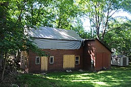
John A. DeBaun Mill i Tallman i Ramapo.
| |
| Land | |
|---|---|
| Delstat | New York |
| County | Rockland County |
| Höjdläge | 113 m ö.h. |
| Koordinater | 41°8′28″N 74°10′7″V / 41.14111°N 74.16861°V |
| Yta | 160 km² (2020) |
| - land | 158 km² |
| - vatten | 2 km² |
| Folkmängd | 148 927 (2020) |
| Befolkningstäthet | 943 invånare/km² |
| Tidszon | EST (UTC-5) |
| - sommartid | EDT (UTC-4) |
| Riktnummer | 845 |
| FIPS | 3660510 |
| Geonames | 5133371 |
|
Ortens läge i delstaten New York
| |
|
New Yorks läge i USA
| |
| Webbplats: http://www.ramapo.org/ | |
Ramapo är en kommun (town) i Rockland County i delstaten New York.[1] Vid 2020 års folkräkning hade Ramapo 148 927 invånare.[2]
Källor
[redigera | redigera wikitext]- ^ Ramapo, NY. Map Quest. Läst 27 januari 2020.
- ^ Ramapo town, Rockland County, New York. City and Town Population Totals, 2020-2021. United States Census Bureau. Läst 10 maj 2023.
|


