Pott Shrigley
Utseende
| Pott Shrigley | |
| Civil parish | |
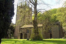
Saint Christopher's Church
| |
| Land | |
|---|---|
| Riksdel | England |
| Enhetskommun | Cheshire East |
| Ceremoniellt grevskap | Cheshire |
| Koordinater | 53°19′16″N 2°04′36″V / 53.32105°N 2.07664°V |
| Geonames | 2639962 7293011 |
Pott Shrigley är en civil parish i Cheshire East i England i Storbritannien.[1]
Källor
[redigera | redigera wikitext]Noter
[redigera | redigera wikitext]- ^ Pott Shrigley hos Geonames.org (cc-by); post uppdaterad 2010-10-17; databasdump nerladdad 2016-05-06

