Pool
Utseende
Pool kan avse:
- Pool – en simbassäng eller badbassäng, se Bassäng
- Pool (cigarett) – ett cigarettmärke från Nederländerna
- Pool (film) – svensk film från 2020
- Pool (musikalbum) – ett musikalbum av Lasse Lindh från 2008
- Pool (roman) – bok skriven av Per Hagman
- Pool (sport) – en grupp av lag i ett idrottsmästerskap
- Bilpool – delägare till en bil
Geografi
[redigera | redigera wikitext]Kongo-Brazzaville
[redigera | redigera wikitext]Pool i Kongo-Brazzaville.
Storbritannien
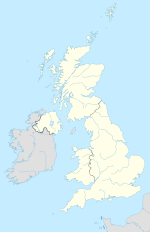
[redigera | redigera wikitext]Pool i Storbritannien.
- Pool (parish), England, West Yorkshire, Leeds, 53°53′52″N 1°38′08″V / 53.89769°N 1.63561°V
- Pool, Carn Brea – ett litet samhälle i Carn Brea, Cornwall, 50°13′44″N 5°16′25″V / 50.22901°N 5.27374°V
- Pool, Scillyöarna, England, Cornwall, Scillyöarna, Bryher, 49°57′02″N 6°21′24″V / 49.950626°N 6.3567603°V
- Pool-in-Wharfedale, England, West Yorkshire, Leeds, Pool, 53°54′00″N 1°37′00″V / 53.9°N 1.61667°V
Se även
[redigera | redigera wikitext]- Pol – flera
- Biljard
- Mount Pool – flera
- Poole (olika betydelser)
| Det här är en förgreningssida, som består av en lista på olika betydelser hos artikelnamnet. Om du kom hit via en wikilänk i en annan artikel, gå gärna tillbaka dit och korrigera länken så att den pekar direkt på den sida som länken avser. |


