Pomona, Kansas
Utseende
| Pomona | |
| Stad (city) | |
| Land | |
|---|---|
| Delstat | |
| County | Franklin County |
| Höjdläge | 293 m ö.h. |
| Koordinater | 38°36′33″N 95°27′6″V / 38.60917°N 95.45167°V |
| Area | 1,95 km² (2010)[1][2] |
| Folkmängd | 884 (2020)[3] |
| Befolkningstäthet | 453 invånare/km² |
| Tidszon | CST (UTC-6) |
| - sommartid | CDT (UTC-5) |
| ZIP-kod | 66076 |
| GNIS-kod | 479638 |
| Geonames | 4277554 7164370 |
|
Översiktskarta
| |
|
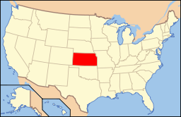
Kansas läge i USA
| |
| Webbplats: http://www.pomonaks.com/ | |
| Redigera Wikidata | |
Pomona är en ort i Franklin County i Kansas.[4] Vid 2020 års folkräkning hade Pomona 884 invånare.[5]
Källor
[redigera | redigera wikitext]- ^ United States Census Bureau, 2016 U.S. Gazetteer Files, United States Census Bureau, 2016.[källa från Wikidata]
- ^ United States Census Bureau, 2010 U.S. Gazetteer Files, United States Census Bureau, 2010, läst: 9 juli 2020.[källa från Wikidata]
- ^ United States Census Bureau (red.), USA:s folkräkning 2020, läs online, läst: 1 januari 2022.[källa från Wikidata]
- ^ Pomona, KS. Map Quest. Läst 14 februari 2020.
- ^ ”Pomona city, Kansas 2020 Decennial Census” (på engelska). United States Census Bureau. https://data.census.gov/profile/Pomona_city,_Kansas?g=160XX00US2057000. Läst 31 mars 2023.


