Hoppa till innehållet

Lista över vulkaner i Mexiko

Från Wikipedia
Karta över alla koordinater från Wikimap eller OSM
Exportera alla koordinater som KML
Exportera alla koordinater som Geo RSS
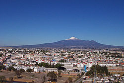
Iztaccihuatl
Matlalcueitl
Nevado de Toluca
Pico Orizaba Pines
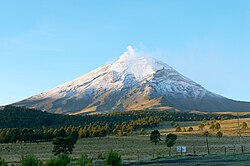
Popocatepetl

Detta är en lista över vulkaner i Mexiko.

Namn Höjd (m ö.h.) Koordinater Senaste utbrott
Los Atlixcos 800 19°48′32″N 96°31′34″V / 19.809°N 96.526°V / 19.809; -96.526 -
Barcena 332 19°18′N 110°49′V / 19.30°N 110.82°V / 19.30; -110.82 1953
Ceboruco 2280 21°07′30″N 104°30′29″V / 21.125°N 104.508°V / 21.125; -104.508 1875
Cerro Prieto 223 32°25′05″N 115°18′18″V / 32.418°N 115.305°V / 32.418; -115.305 Holocen
Chichinautzin 3930 19°05′N 99°08′V / 19.08°N 99.13°V / 19.08; -99.13 -
El Chichón 1060 17°20′N 93°12′V / 17.33°N 93.20°V / 17.33; -93.20 1982
Cofre de Perote 4282 19°29′31″N 97°09′00″V / 19.492°N 97.15°V / 19.492; -97.15 -
Colima 4330 19°31′N 103°37′V / 19.51°N 103.62°V / 19.51; -103.62 2006
Comondú-La Purísima 780 26°00′N 111°55′V / 26.00°N 111.92°V / 26.00; -111.92 -
Coronado 440 29°04′48″N 113°30′47″V / 29.08°N 113.513°V / 29.08; -113.513 -
Cuexcomate 13 - -
Las Cumbres 3940 19°09′N 97°16′V / 19.15°N 97.27°V / 19.15; -97.27 ~3940 f.kr
Las Derrumbadas 1500 19°12′N 97°18′V / 19.20°N 97.30°V / 19.20; -97.30 -
Durango Volcanic Field 2075 24°09′N 104°26′V / 24.15°N 104.43°V / 24.15; -104.43 -
La Gloria Volcanic Field 3600 19°20′N 97°15′V / 19.33°N 97.25°V / 19.33; -97.25 -
Guadalupe 1100 29°04′N 118°17′V / 29.07°N 118.28°V / 29.07; -118.28 -
Los Humeros 3150 19°41′N 97°27′V / 19.68°N 97.45°V / 19.68; -97.45 Holocen
Iztaccihuatl 5286 19°12′N 98°36′V / 19.2°N 98.6°V / 19.2; -98.6 -
Jaraguay Volcanic Field 960 29°20′N 114°30′V / 29.33°N 114.50°V / 29.33; -114.50 Holocen
Jocotitlan 3900 19°43′26″N 99°45′25″V / 19.724°N 99.757°V / 19.724; -99.757 1270 ± 75 år
Jorullo 3170 19°29′N 102°15′V / 19.48°N 102.25°V / 19.48; -102.25 -
Matlalcueitl 4461 19°14′N 98°02′V / 19.23°N 98.03°V / 19.23; -98.03 -
Mascota Volcanic Field 2540 20°37′N 104°50′V / 20.62°N 104.83°V / 20.62; -104.83 Holocen
Michoacan-Guanajuato 3860 19°29′N 102°15′V / 19.48°N 102.25°V / 19.48; -102.25 1952
Naolinco Volcanic Field 2000 19°40′N 96°45′V / 19.67°N 96.75°V / 19.67; -96.75 Holocen
Nevado de Toluca 4690 19°06′29″N 99°45′29″V / 19.108°N 99.758°V / 19.108; -99.758 1350 f.kr
Papayo 3600 19°18′29″N 98°42′00″V / 19.308°N 98.70°V / 19.308; -98.70 Holocen
Paricutín 3170 19°30′N 102°12′V / 19.5°N 102.2°V / 19.5; -102.2 1952
Pico de Orizaba 5700 19°01′01″N 97°16′12″V / 19.017°N 97.27°V / 19.017; -97.27 1537
Pinacate 1200 31°46′19″N 113°29′53″V / 31.772°N 113.498°V / 31.772; -113.498 -
Popocatepetl 5426 19°01′23″N 98°37′19″V / 19.023°N 98.622°V / 19.023; -98.622 2006
San Borja Volcanic Field 1360 28°30′N 113°45′V / 28.50°N 113.75°V / 28.50; -113.75 Holocen
Isla San Luis 180 29°48′50″N 114°23′02″V / 29.814°N 114.384°V / 29.814; -114.384 Holocen
San Martin Tuxtla 1650 18°34′12″N 95°19′12″V / 18.57°N 95.320°V / 18.57; -95.320 1796
San Quintin Volcanic Field 260 30°28′05″N 115°59′46″V / 30.468°N 115.996°V / 30.468; -115.996 Holocen
Sanganguey 2353 21°27′N 104°44′V / 21.45°N 104.73°V / 21.45; -104.73 1742
Serdan-Oriental 3485 19°16′N 97°28′V / 19.27°N 97.47°V / 19.27; -97.47 Holocen
Socorro 1050 18°47′N 110°57′V / 18.78°N 110.95°V / 18.78; -110.95 1993
Tacaná 4060 15°08′N 92°07′V / 15.13°N 92.11°V / 15.13; -92.11 1986
Isla Tortuga 210 27°23′31″N 111°51′29″V / 27.392°N 111.858°V / 27.392; -111.858 Holocen
Tres Virgenes 1940 27°25′N 112°35′V / 27.42°N 112.59°V / 27.42; -112.59 1857
Zitacuaro-Valle de Bravo 3500 19°24′N 100°15′V / 19.40°N 100.25°V / 19.40; -100.25 -