Lezíria do Tejo
| Lezíria do Tejo | |
| Statistisk underregion (NUTS 3) | |
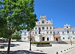
Lezíria do Tejo i närheten av staden Santarém
| |
| Land | |
|---|---|
| Statistisk region (NUTS 2) | Alentejo |
| Huvudort | Santarém |
| Yta | 4 275 km² |
| Folkmängd | 247 453 (2011) |
| Webbplats: https://www.cimlt.eu/ | |

Lezíria do Tejo (svenska Tejo-flodens översvämningsslätt) är en statistisk underregion (NUTS 3) i södra Portugal. Den är en del av den statistiska regionen Alentejo (NUTS 2), och omfattar flera kommuner i distriktet Santarém samt en kommun i distriktet Lissabon.[1]
Ytan uppgår till 4275 km² och befolkningen till 247 453 invånare (2011). Underregionen (NUTS 3) Lezíria do Tejo sammanfaller geografiskt med Comunidade Intermunicipal da Lezíria do Tejo ("Lezíria do Tejos kommunalförbund"; ”CIMLT”). Dess viktigaste orter är Santarém (huvudorten), Rio Maior, Almeirim och Cartaxo. [1][2]
Kommuner
[redigera | redigera wikitext]Lezíria do Tejo omfattar 11 kommuner (concelhos).[2]
Största orter
[redigera | redigera wikitext]-
Kommunerna i Lezíria do Tejo
-
Runt staden Vila Franca de Xira
-
Borgen vid Alcanede
-
Katedralen i Santarém
-
Åkermark i Azambuja
-
Romersk bro i Alcanede
Se även
[redigera | redigera wikitext]Referenser
[redigera | redigera wikitext]- ^ [a b] ”Conheça a nova Nomenclatura das Unidades Territoriais para fins Estatísticos (NUTS 2013)” (på portugisiska). Economia e Finanças. https://economiafinancas.com/2015/conheca-a-nova-nomenclatura-das-unidades-territoriais-para-fins-estatisticos-nuts-2013/. Läst 4 oktober 2022.
- ^ [a b] ”Comunidade Intermunicipal da Lezíria do Tejo (CIMLT)” (på portugisiska). Comunidade Intermunicipal da Lezíria do Tejo. https://www.cimlt.eu/cimlt/quem-somos. Läst 4 oktober 2022.
| |||||||||||||


