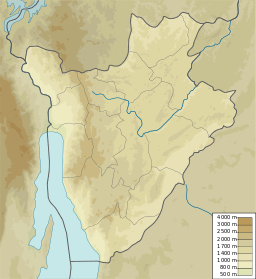
Kaziramihunda (vattendrag i Burundi, Cibitoke)
Utseende
| Kaziramihunda | |
| Vattendrag | |
| Länder | |
|---|---|
| Koordinater | 2°44′47″S 29°19′59″Ö / 2.7463°S 29.3331°Ö |
| Tidszon | CAT (UTC+2) |
| Geonames | 7592504 |
Kaziramihunda är ett vattendrag som ingår i gränsen mellan Burundi och Rwanda. Det mynnar i Kaburantwa.[1]
Källor
[redigera | redigera wikitext]- ^ The Geographer (1966). ”Burundi – Rwanda Boundary” (på engelska). International Boundary Study (Washington DC: Office of the Geographer, Bureau of Intelligence and Research) 72: sid. 5. http://library.law.fsu.edu/Digital-Collections/LimitsinSeas/pdf/ibs072.pdf. Läst 31 oktober 2022.

