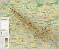
Fil:Thüringer Wald - Deutsche Mittelgebirge, Serie A-de.png
Utseende

Storlek på förhandsvisningen: 713 × 600 pixlar. Andra upplösningar: 285 × 240 pixlar | 571 × 480 pixlar | 913 × 768 pixlar | 1 218 × 1 024 pixlar | 2 200 × 1 850 pixlar.
Originalfil (2 200 × 1 850 pixlar, filstorlek: 5,3 Mbyte, MIME-typ: image/png)
Filhistorik
Klicka på ett datum/klockslag för att se filen som den såg ut då.
| Datum/Tid | Miniatyrbild | Dimensioner | Användare | Kommentar | |
|---|---|---|---|---|---|
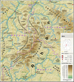
| nuvarande | 13 mars 2022 kl. 20.15 |  | 2 200 × 1 850 (5,3 Mbyte) | Thoroe | + Kleiner Thüringer Wald |
| 8 mars 2022 kl. 11.38 |  | 2 200 × 1 850 (5,3 Mbyte) | Thoroe | Detailänderungen | |
| 6 mars 2022 kl. 17.58 |  | 2 200 × 1 850 (5,29 Mbyte) | Thoroe | {{Information |Description={{en|1=Topographic map of the Thuringian Forest}} {{de|1=Topografische Karte des Thüringer Waldes}} |Source={{Own using}} *[http://gmt.soest.hawaii.edu Generic Mapping Tools (GMT)] with [http://dds.cr.usgs.gov/srtm/version2_1/SRTM3/ SRTM3 V2.1 data] *[http://www.openstreetmap.org OpenStreetMap] data *File:Karte_Bundesrepublik_Deutschland.svg by David Liuzzo |Date=2022-03-06 |Author= [[User:... |
Filanvändning
Följande sida använder den här filen:
Global filanvändning
Följande andra wikier använder denna fil:
- Användande på bg.wikipedia.org
- Användande på ceb.wikipedia.org
- Användande på da.wikipedia.org
- Användande på de.wikipedia.org
- Användande på en.wikipedia.org
- Användande på eo.wikipedia.org
- Användande på es.wikipedia.org
- Användande på et.wikipedia.org
- Användande på fa.wikipedia.org
- Användande på fr.wikipedia.org
- Användande på it.wikipedia.org
- Användande på lt.wikipedia.org
- Användande på nl.wikipedia.org
- Användande på nn.wikipedia.org
- Användande på no.wikipedia.org
- Användande på pl.wikipedia.org
- Användande på sl.wikipedia.org


