
Fil:Tectonic plates hotspots-en.svg

Storleken för denna PNG-förhandsvisning av denna SVG-fil: 800 × 547 pixlar. Andra upplösningar: 320 × 219 pixlar | 640 × 437 pixlar | 1 024 × 700 pixlar | 1 280 × 874 pixlar | 2 560 × 1 749 pixlar | 1 092 × 746 pixlar.
Originalfil (SVG-fil, standardstorlek: 1 092 × 746 pixlar, filstorlek: 898 kbyte)
| Denna fil tillhandahålls av Wikimedia Commons. Informationen nedan är kopierad från dess filbeskrivningssida. |
Sammanfattning
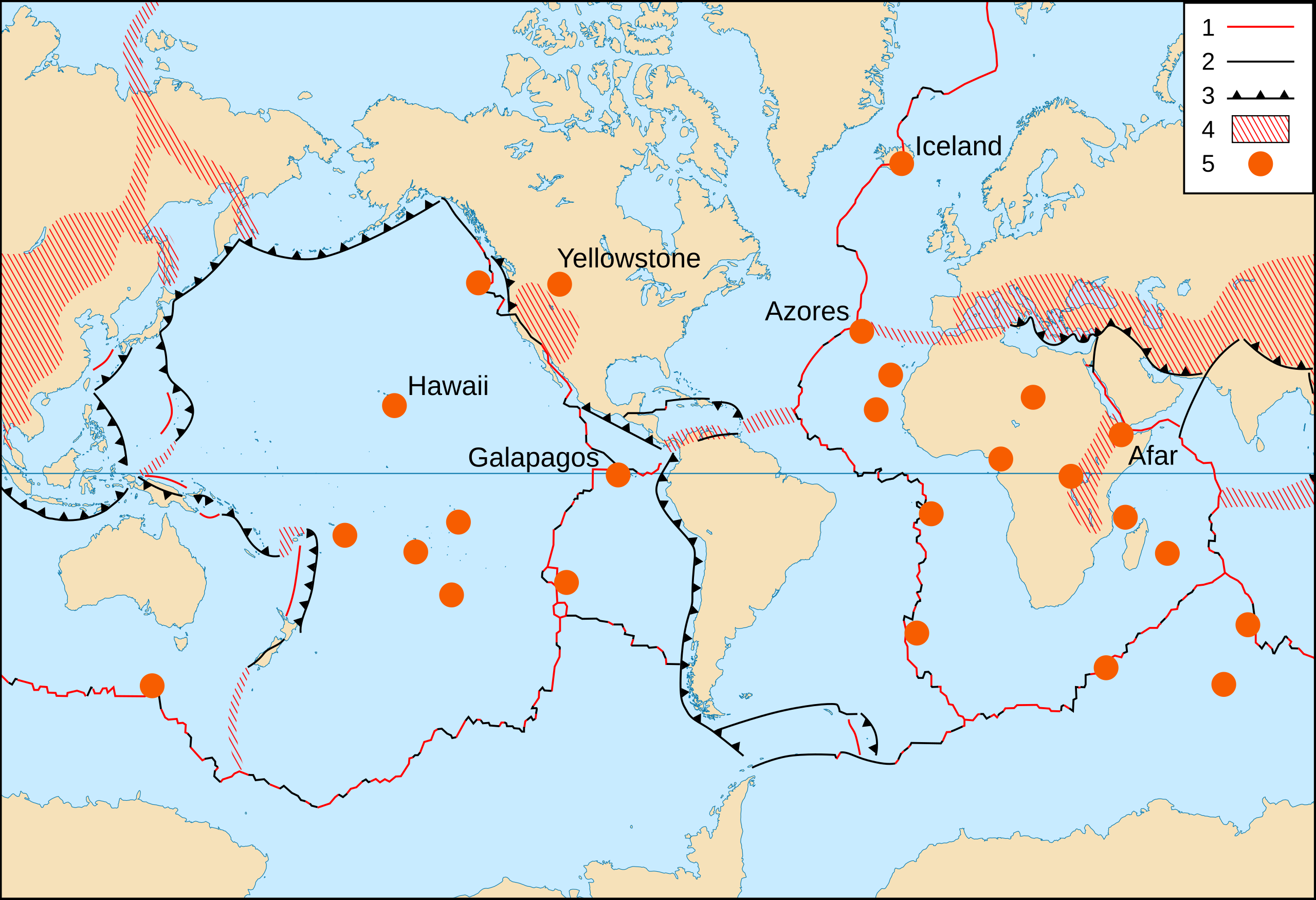
- Key :
- 1 : Divergent plate boundaries ;
- 2 : Transform plate boundaries ;
- 3 : Convergent plate boundaries ;
- 4 : Plate boundary zones ;
- 5 : Selected prominent hotspots.
| Beskrivning |
English: World map in English of selected prominent geological hotspots.
Français : Carte en anglais des principaux points chauds géologiques mondiaux. |
| Datum | 2006-10, upgraded 2015-09 |
| Källa |
|
| Skapare | Eric Gaba (Sting - fr:Sting) |
| Tillstånd (Återanvändning av denna fil) |
Public domain |
| Andra versioner |
Filer som bygger på denna fil:
|


Licensiering
This image is in the public domain in the United States because it only contains materials that originally came from the United States Geological Survey, an agency of the United States Department of the Interior. For more information, see the official USGS copyright policy.
|
| This work was previously under Public Domain, or a Free License. It has been digitally enhanced and/or modified. This derivative work has been (or is hereby) released into the public domain by its author, Sting at the French Wikipedia project. This applies worldwide. In some countries this is not legally possible; if so:
|
Filhistorik
Klicka på ett datum/klockslag för att se filen som den såg ut då.
| Datum/Tid | Miniatyrbild | Dimensioner | Användare | Kommentar | |
|---|---|---|---|---|---|
| nuvarande | 6 september 2015 kl. 23.17 | | 1 092 × 746 (898 kbyte) | Sting | Upgraded background map using NGDC WCL data |
| 2 juni 2008 kl. 23.38 |  | 1 100 × 750 (373 kbyte) | Sting | Display bug correction | |
| 2 mars 2008 kl. 10.58 |  | 1 100 × 750 (182 kbyte) | QWerk | Cleaned code. Lets see does it work now. | |
| 22 oktober 2006 kl. 01.25 | Ingen miniatyrbild | (397 kbyte) | Sting | * '''Key :''' :'''1 :''' Divergent plate boundaries ; :'''2 :''' Convergent plate boundaries ; :'''3 :''' Transform plate boundaries ; :'''4 :''' Plate boundary zones ; :'''5 :''' Selected prominent hotspots. {{Information |Description=World map in Engl |
Filanvändning
Inga sidor använder den här filen.
Global filanvändning
Följande andra wikier använder denna fil:
- Användande på ar.wikipedia.org
- Användande på ca.wikipedia.org
- Användande på cs.wikipedia.org
- Användande på de.wikipedia.org
- Användande på es.wikipedia.org
- Användande på ja.wikipedia.org
- Användande på no.wikipedia.org
- Användande på pt.wikipedia.org
- Användande på simple.wikipedia.org
- Användande på sl.wikipedia.org