
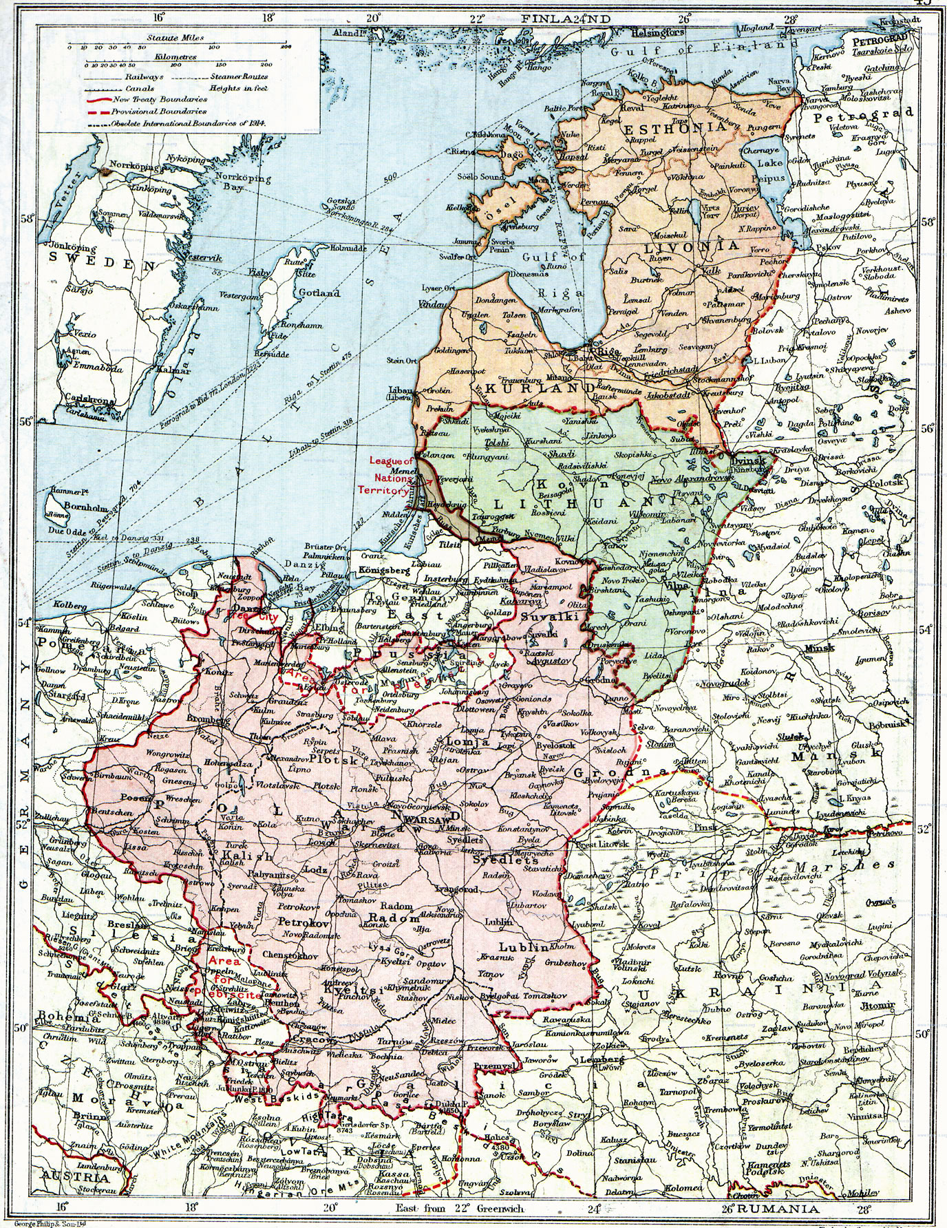
Fil:Poland & The New Baltic States.jpg
Storlek på förhandsvisningen: 462 × 599 pixlar. Andra upplösningar: 185 × 240 pixlar | 370 × 480 pixlar | 592 × 768 pixlar | 790 × 1 024 pixlar | 1 376 × 1 784 pixlar.
Originalfil (1 376 × 1 784 pixlar, filstorlek: 1,22 Mbyte, MIME-typ: image/jpeg)
| Denna fil tillhandahålls av Wikimedia Commons. Informationen nedan är kopierad från dess filbeskrivningssida. |
| Beskrivning |
English: Map of Poland, en:Lithuania, en:Courland, en:Livonia and en:Esthonia published in the 1920 edition of The Peoples Atlas by London Geographical Institute.
The map shows the situation after the treaties of Versailles and Brest-Litovsk and before the en:Peace of Riga and the organization and recognition of the nation-states of en:Estonia and en:Latvia. Note that most names featured on this map are pre-1914 Russian names put in English transcription, rather than local or English names as such. |
| Datum | |
| Källa |
This uploaded map is a photoshopped version of the original image located at Image:London-geographical-institute the-peoples-atlas 1920 poland-and-the-new-baltic-states.jpg or [1]. Originally uploaded to EN Wikipedia as en:Image:Poland & The New Baltic States.jpg by en:User:MaGioZal 26 December 2007 |
| Skapare | London Geographical Institute |
| Tillstånd (Återanvändning av denna fil) |
According to the site, there are no copyrights to this map. |
| Andra versioner | Image:London-geographical-institute the-peoples-atlas 1920 poland-and-the-new-baltic-states.jpg |
Denna mediafil är allmän egendom i Förenta staterna. Detta gäller amerikanska verk där upphovsrätten har gått ut, ofta p.g.a. att den första publiceringen skedde före den 1 januari 1929. Se denna sida för mer information.
|
 | |
 |
Denna bild kanske inte är allmän egendom utanför Förenta staterna. Detta gäller speciellt de länder och områden där regeln om kortare sikt inte gäller för amerikanska verk; som Kanada, Fastlandskina (inte Hong Kong eller Macao), Tyskland, Mexiko och Schweiz. Skaparen och publiceringsåret är viktig information och måste anges. Se Wikipedia:Public domain och Wikipedia:Copyrights för mer information.
|
Filhistorik
Klicka på ett datum/klockslag för att se filen som den såg ut då.
| Datum/Tid | Miniatyrbild | Dimensioner | Användare | Kommentar | |
|---|---|---|---|---|---|
| nuvarande | 26 juni 2010 kl. 16.06 | | 1 376 × 1 784 (1,22 Mbyte) | Ras67 | losslessly cropped with Jpegcrop |
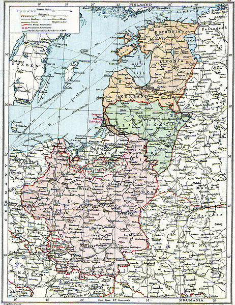
| 3 augusti 2008 kl. 09.47 |  | 1 506 × 1 996 (1,28 Mbyte) | Rcbutcher | {{Information |Description=Map of Poland, Lithuania, Courland, Livonia and Esthonia published in the 1920 edition of ''The Peoples Atlas'' by London Geographical Institute. The map shows the situation after the treaties of [[Treaty of |
Filanvändning
Följande sida använder den här filen:
Global filanvändning
Följande andra wikier använder denna fil:
- Användande på ar.wikipedia.org
- Användande på bat-smg.wikipedia.org
- Användande på ba.wikipedia.org
- Användande på ca.wikipedia.org
- Användande på da.wikipedia.org
- Användande på de.wikipedia.org
- Användande på en.wikipedia.org
- Användande på et.wikipedia.org
- Användande på fi.wikipedia.org
- Användande på fr.wikipedia.org
- Användande på gl.wikipedia.org
- Användande på it.wikipedia.org
- Användande på ja.wikipedia.org
- Användande på lt.wikipedia.org
- Användande på lt.wikibooks.org
- Användande på lv.wikipedia.org
- Användande på no.wikipedia.org
- Användande på ro.wikipedia.org
- Användande på ru.wikipedia.org
- Användande på sl.wikipedia.org
- Användande på sr.wikipedia.org
- Användande på tr.wikipedia.org
Visa mer globalt användande av denna fil.