
Fil:MountSidleyWaescheMap.jpg

Storlek på förhandsvisningen: 750 × 600 pixlar. Andra upplösningar: 300 × 240 pixlar | 600 × 480 pixlar | 1 000 × 800 pixlar.
Originalfil (1 000 × 800 pixlar, filstorlek: 181 kbyte, MIME-typ: image/jpeg)
| Denna fil tillhandahålls av Wikimedia Commons. Informationen nedan är kopierad från dess filbeskrivningssida. |
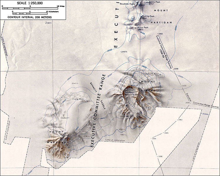
Topographic map of Mounts Sidley and Waesche (1:250,000 scale)
Source: http://usarc.usgs.gov/antarctic_atlas/ USGS Atlas of Antarctic Research
This image is in the public domain in the United States because it only contains materials that originally came from the United States Geological Survey, an agency of the United States Department of the Interior. For more information, see the official USGS copyright policy.
|
Filhistorik
Klicka på ett datum/klockslag för att se filen som den såg ut då.
| Datum/Tid | Miniatyrbild | Dimensioner | Användare | Kommentar | |
|---|---|---|---|---|---|
| nuvarande | 16 januari 2005 kl. 02.51 | | 1 000 × 800 (181 kbyte) | GarciaB~commonswiki | Topographic map of Mounts Sidley and Waesche (1:250,000 scale) |
Filanvändning
Följande sida använder den här filen:
Global filanvändning
Följande andra wikier använder denna fil:
- Användande på ar.wikipedia.org
- Användande på ast.wikipedia.org
- Användande på bg.wikipedia.org
- Användande på bs.wikipedia.org
- Användande på ceb.wikipedia.org
- Användande på de.wikipedia.org
- Användande på en.wikipedia.org
- Användande på es.wikipedia.org
- Användande på fr.wikipedia.org
- Användande på ja.wikipedia.org
- Användande på lld.wikipedia.org
- Användande på nn.wikipedia.org
- Användande på no.wikipedia.org
- Användande på pl.wikipedia.org
- Användande på ru.wikipedia.org
- Användande på tr.wikipedia.org
- Användande på uk.wikipedia.org
- Användande på www.wikidata.org
- Användande på zh.wikipedia.org