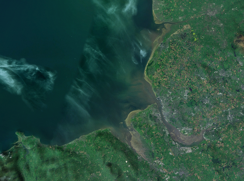
Fil:Liverpool Bay.png
Utseende

Storlek på förhandsvisningen: 800 × 593 pixlar. Andra upplösningar: 320 × 237 pixlar | 640 × 474 pixlar | 1 024 × 759 pixlar | 1 278 × 947 pixlar.
Originalfil (1 278 × 947 pixlar, filstorlek: 1,84 Mbyte, MIME-typ: image/png)
Filhistorik
Klicka på ett datum/klockslag för att se filen som den såg ut då.
| Datum/Tid | Miniatyrbild | Dimensioner | Användare | Kommentar | |
|---|---|---|---|---|---|
| nuvarande | 28 april 2007 kl. 15.06 |  | 1 278 × 947 (1,84 Mbyte) | Smurrayinchester | {{Information |Description=A satellite photograph of w:Liverpool Bay, showing the Rivers Dee and Mersey (centre), the River Alt (north) and the River Conwy (west). |Source=NASA World Wind - Landsat 7 |Date=28 April 2007 |Author= [[User:Smurrayincheste |
Filanvändning
Följande sida använder den här filen:
Global filanvändning
Följande andra wikier använder denna fil:
- Användande på ca.wikipedia.org
- Användande på ceb.wikipedia.org
- Användande på cy.wikipedia.org
- Användande på en.wikipedia.org
- Användande på eo.wikipedia.org
- Användande på es.wikipedia.org
- Användande på et.wikipedia.org
- Användande på it.wikipedia.org
- Användande på nl.wikipedia.org
- Användande på nn.wikipedia.org
- Användande på no.wikipedia.org
- Användande på pl.wikipedia.org
- Användande på pl.wiktionary.org
- Användande på ru.wikipedia.org
- Användande på sr.wikipedia.org
- Användande på vi.wikipedia.org
- Användande på www.wikidata.org


