
Fil:Dorset UK relief location map.jpg

Storlek på förhandsvisningen: 800 × 556 pixlar. Andra upplösningar: 320 × 222 pixlar | 640 × 445 pixlar | 1 024 × 712 pixlar | 1 280 × 889 pixlar | 1 999 × 1 389 pixlar.
Originalfil (1 999 × 1 389 pixlar, filstorlek: 301 kbyte, MIME-typ: image/jpeg)
| Denna fil tillhandahålls av Wikimedia Commons. Informationen nedan är kopierad från dess filbeskrivningssida. |
| Beskrivning |
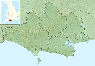
Relief map of Dorset, UK. Equirectangular map projection on WGS 84 datum, with N/S stretched 155% Geographic limits:
|
| Datum | |
| Källa |
|
| Skapare | Nilfanion, created using Ordnance Survey data |
| Tillstånd (Återanvändning av denna fil) |
Denna fil har gjorts tillgänglig under licensen Creative Commons Erkännande-Dela Lika 3.0 Unported Erkännande: Contains Ordnance Survey data © Crown copyright and database right
|
| Andra versioner | File:Dorset UK district map (blank).svg - Blank map |
.svg)
Filhistorik
Klicka på ett datum/klockslag för att se filen som den såg ut då.
| Datum/Tid | Miniatyrbild | Dimensioner | Användare | Kommentar | |
|---|---|---|---|---|---|
| nuvarande | 29 november 2011 kl. 03.29 | | 1 999 × 1 389 (301 kbyte) | Nilfanion | {{Information |Description=Relief map of Dorset, UK. Equirectangular map projection on WGS 84 datum, with N/S stretched 155% Geographic limits: *West: 2.99W *East: 1.65W *North: 51.10N *South: 50.50N |Source=[[w:Ordnance Survey|Ordnance Sur |
Filanvändning
Följande sida använder den här filen:
Global filanvändning
Följande andra wikier använder denna fil:
- Användande på ar.wikipedia.org
- Användande på bg.wikipedia.org
- Användande på ceb.wikipedia.org
- Användande på el.wikipedia.org
- Användande på en.wikipedia.org
- River Frome, Dorset
- Poole Harbour
- Lulworth Cove
- River Piddle
- Ballard Down
- River Wey, Dorset
- Radipole Lake
- Hambledon Hill
- Wytch Farm
- River Allen, Dorset
- River Tarrant
- Ringstead Bay
- Lewesdon Hill
- Lulworth Castle
- Poole Bay
- White Nothe
- River Hooke
- River Bourne, Dorset
- Chapman's Pool
- River Asker
- Bournemouth Reform Synagogue
- Pondfield Cove
- Bournemouth Community Hebrew Congregation
- River Brit
- Weymouth Lifeboat Station
- Mudeford Lifeboat Station
- Poole Lifeboat Station
- Thorncombe Beacon
- Halsewell (East Indiaman)
- Ball Hill, Dorset
- Dogbury Hill
- Beaminster Down
- St James's Church, Kingston, Purbeck
- River Bride, Dorset
- Siege of Lyme Regis
- Module:Location map/data/United Kingdom Dorset
- Module:Location map/data/Dorset
Visa mer globalt användande av denna fil.