
Fil:Bering Sea Aleutian Is Alaska map.png
Storlek på förhandsvisningen: 684 × 599 pixlar. Andra upplösningar: 274 × 240 pixlar | 548 × 480 pixlar | 876 × 768 pixlar | 1 168 × 1 024 pixlar | 1 457 × 1 277 pixlar.
Originalfil (1 457 × 1 277 pixlar, filstorlek: 2,04 Mbyte, MIME-typ: image/png)
| Denna fil tillhandahålls av Wikimedia Commons. Informationen nedan är kopierad från dess filbeskrivningssida. |
Sammanfattning
| Beskrivning |
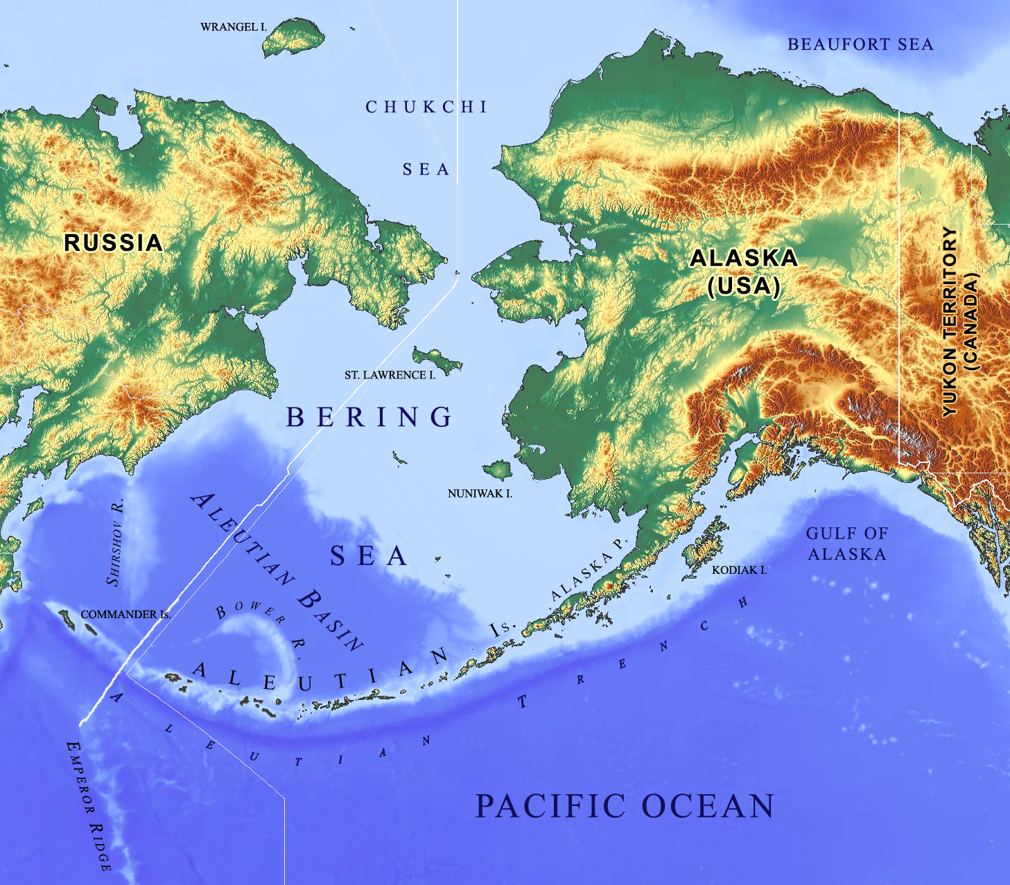
English: Physical geography of Alaska and the Bering Sea with emphasis on oceanographic features of the Bering Sea and the Commander-Aleutian island arc. |
| Datum | |
| Källa |
Eget arbete |
| Skapare | Base map: © OpenStreetMap contributors |
| Andra versioner |
   |
Licensiering
Denna fil har gjorts tillgänglig under licensen Creative Commons Erkännande-Dela Lika 2.0 Generisk
- Du är fri:
- att dela – att kopiera, distribuera och sända verket
- att remixa – att skapa bearbetningar
- På följande villkor:
- erkännande – Du måste ge lämpligt erkännande, ange en länk till licensen och indikera om ändringar har gjorts. Du får göra det på ett lämpligt sätt, men inte på ett sätt som antyder att licensgivaren stödjer dig eller din användning.
- dela lika – Om du remixar, transformerar eller bygger vidare på materialet måste du distribuera dina bidrag under samma eller en kompatibel licens som originalet.
Filhistorik
Klicka på ett datum/klockslag för att se filen som den såg ut då.
| Datum/Tid | Miniatyrbild | Dimensioner | Användare | Kommentar | |
|---|---|---|---|---|---|
| nuvarande | 10 februari 2017 kl. 22.20 | | 1 457 × 1 277 (2,04 Mbyte) | Gretarsson | wrong map uploaded |
| 10 februari 2017 kl. 22.15 |  | 1 457 × 1 277 (1,95 Mbyte) | Gretarsson | incorrect hyphens removed | |
| 10 februari 2017 kl. 22.06 |  | 1 457 × 1 277 (2,04 Mbyte) | Gretarsson | {{Information |Description ={{en|1=Physical geography of Alaska and the Bering Sea with emphasis on oceanographic features of the Bering Sea and the Commander-Aleutian arc.}} |Source ={{own}}<br /> Base map is from https://maps-for-free.com... |
Filanvändning
Följande sida använder den här filen:
Global filanvändning
Följande andra wikier använder denna fil:
- Användande på bg.wikipedia.org
- Användande på eu.wikipedia.org
- Användande på nn.wikipedia.org
- Användande på uk.wikipedia.org